Showing posts with label travel. Show all posts

Tuesday, May 15, 2012

Images of Bhutan - Leg 4 - Tiger's Nest to the Paro Tsetschu

At the Paro Tsetschu
For more than a year, we planned our trip with Mom around the five day Druk Path trek, during which we spent three days above 13,000 feet in the foothills of the Himalayas.  After successfully finishing the walk and descending back into the relatively thick air of the Thimphu valley, we hardly had time to enjoy our sense of gratitude and satisfaction and reflect on the experience, because our trip had not yet come to an end.  Over the next two days, our itinerary would take us to the Tiger's Nest monastery, a famous holy site that draws people from around the world, as well as one of the annual festivals - the Paro Tesetschu - which often provides the main focus for many tourists who visit Bhutan.  In between, the ladies still managed to squeeze in a bit more shopping, and we stopped in to visit more of the beautiful religious sites in the Paro and Thimphu valleys.  We could sense the end of our journey approaching, but, as with the whole trip, our surroundings helped us to stay focused on the present.   


Thursday, May 3, 2012

Images of Bhutan - Leg 3 - Dochu La to the Druk Path Trek

The Views of the Himalayas from the Druk Path Trek
After visiting the beautiful farm land and religious sites of the Punakha valley, we anxiously piled back into our trusty mini-van for the drive back towards Thimphu and Paro en route to the start of the Druk Path trek.  For many months we had read about this five-day trekking route, which traverses a high ridge line between the two main valleys of Western Bhutan.  We were excited to leave the roads behind and travel on foot, but first we would have to  negotiate Dochu La one final time.


Tuesday, April 24, 2012

Images of Bhutan - Leg 2 - Thimphu to Punakha


The Golden Buddha
After an amazing visit to the Haa Valley, Madge, Kristin and I loaded into the min-van with Chundu, our guide, and Themang, our driver, for the journey to Thimphu.  During our brief stay in the capital of Bhutan, we hooked up with a couple of local trekking guides to climb at the only developed crag in the country - the Nose!  Just a bit smaller than its namesake in Yosemite, the 100-ft Nose basically includes all 14 of Bhutan's established rock routes.  Over the course of a really fun morning, we got to sample 4 of those 14 routes before lunch.

During the rest of our stay in Thimphu, we explored the local markets, visited the Giant Golden Buddha, still under construction, and saw the National Memorial Chorten, where locals spend their days spinning the large prayer wheels and walking clockwise around this holy site for good karma.

Thursday, April 19, 2012

Images of Bhutan - Leg 1 - Chelela Pass to the Haa Valley


In December of 2010, Kristin and I gave my mother Madge a golden ticket for her 70th birthday.  This golden ticket entitled her to a trip anywhere in the world she chose to go.  After a few weeks of research, Madge decided on Bhutan and our preparations began. 

In March of this year, after many long months of planning, the three of us traveled to Bhutan for a two-week tour of the western and central portions of this tiny country.  At approximately 18,000 square miles, Bhutan is roughly the size of Vermont and New Hampshire combined, but this Himalayan kingdom retains a rich and unique cultural and religious heritage all of its own.

The images below tell the story from the first leg of our trip, in which we drove over Chelela Pass, the highest road in the country at close to 13,000 feet, and then descended into the Haa Valley.


Isolated to the west of the main cities of the country, fewer than 10% of the tourists that visit Bhutan venture into this area.  We began our trip with a hike to a tiny, cliff-side monastery, a visit to a local farmhouse for lunch, and a memorable drive down a deeply incised river valley choked with old-growth trees.

if you click on any of the images below, you can view a gallery where you can easily scan through the photos.

You can also see a slide show of these same images set to some local music here: VIMEO slide show.  (Be sure to watch the HD version.)

Over the next couple of weeks, we'll publish shots from the rest of the trip, including the five-day Druk Path trek, a visit to the famed Tiger's Nest monastery, and the annual religious festival in Paro. 

Sunday, October 24, 2010

The Desert Diaries - Moab to Sedona

After a few days of exploring Moab, we have migrated south to the great state of Arizona and are now happily holed up in Sedona, surrounded by another amazing landscape and more sandstone spires.  We were chased from our desert paradise by two irresistible forces.  First, Mother Nature herself, who unleashed a furious rainstorm reminiscent of our home in the Pacific Northwest.  We rode out one day of rain by squatting in the public library and drinking beer in the local brewery.  But with more weather expected over the next week, the sandstone was likely to remain wet into the foreseeable future, and we decided to search out better weather down South.  Second, an injury.

Monday, September 27, 2010

Glacier National Park Teaser


Kristin and I spent an amazing week earlier this month exploring Glacier National Park with my mom.  With too many stories and too many photos, we've had a hell of a time sorting through all the content and getting something posted about the trip.

Instead of waiting until its all organized, we decided to post a little teaser - a short clip of Mom preparing for her assault on Mt. Stanton.  The peak rises 4500' above Lake McDonald on the western edge of the park, and we figured it would make a great little hike on the second day of the trip.   

We won't give it away, but we will say that Mom kicked some serious butt.  Did she summit?  Did she bonk?  Did we lose her on the descent? You'll have to tune back in to find out what happened!  Reality TV at its finest.  

Tuesday, June 3, 2008

Wrapping Up the Trip to Alaska

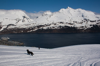
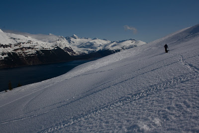
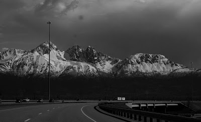
After returning to Anchorage from the Neacolas, I had about a week left on the spring fling and spent it exploring the Chugach and surrounding areas. The weather was off and on, and the snow was detiorating, but I had a great time nonetheless. We got in a ski day in Whitier, Alaska overlooking Prince William Sound.


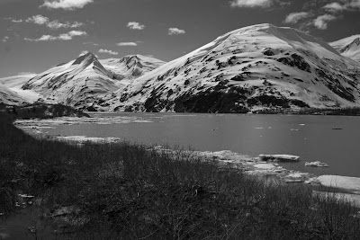
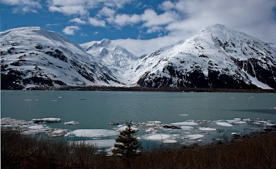
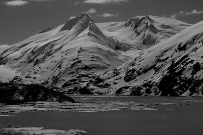
Portage Lake was looking nice! Looks like there are some great climbing and ski mountaineering objectives around here.


I also got in a couple of cool hikes in the Chugach - McHugh Peak, Twin Peaks, Flattop/Peak 2. Fun fun fun.


And managed a day trip to Talkeetna with some sightseeing on the way back.


There are few other photos here.

Friday, May 30, 2008

Neacola Mountains, Alaska - May 10-16, 2008


Yeah, hard work pays off … in vacation time! I had put in some seriously long hours over the past 12 months, and the two-week trip to Alaska was the icing on a spring cake that included the trip to Kalymnos with Kristin. I managed to wrap in a work detour to Barrow, and the whirlwind came together as they always seem to do.

I went up to visit my friend Brian Litmans, who moved back to Anchorage about a year ago. Brian’s into the free-your-hell stuff, so we looked to put together primarily a ski trip. We tossed around a couple of options, including Little Switzerland, but we eventually settled on the Neacola Mountains just outside Lake Clark National Park. We went back and forth on the decision, but we settled on the Neacolas for a couple of reasons. First, we could find very little information about where we wanted to go. Second, we were almost guaranteed not to see a single person while we were there. And third, it looked sweeeet!


Background Research:

We looked around a bit and found some limited information.

These guys went in with Beckey to climb what he recently named Mt. Chakachmna. Apparently, it was Beckey’s second trip to that area, and I’m fairly certain I actually interviewed one of the guys he went with the first time for a job we had open several years ago.

These guys had recently flown in to the same area for a ski trip earlier this year. Their photos definitely encouraged us.

The AAJ also had a bit of information, but not much to go on.

In the end, we decided to land on the same glacier that Beckey’s group and the skiing group had landed on, because it looked like incredible terrain and a good jumping off point for other adventures. Here’s a couple topos of where we were.
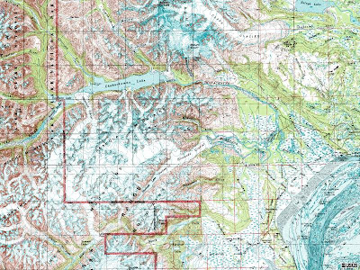
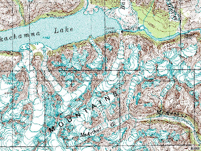


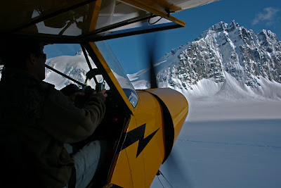
We flew in with Doug Brewer of AK West in Nikiski, and he dropped us off just to the southeast of point 7530 – also known now as Mt. Chakachmna.
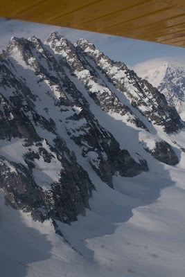


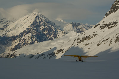
We got dropped off on May 10th under clear skies and calm winds – a beautiful setting – but we could already see the lenticulars forming over the summit of Mt. Spurr to the North. Hmmm … I wonder what it will look like in the morning.


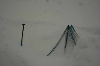
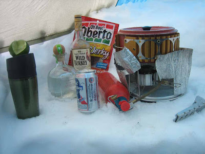
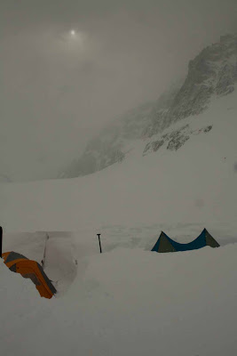
Well, we woke up to about 8” of fresh snow, strong winds, and limited visibility. We wanted to go for a ski tour, but we couldn’t see anything, and the wind was howling, so we decided to hole up for the day. Little did we know it was only going to get worse. Over the next 3-4 days, we got probably 2.5-3’ of snow. We spent most of our time shoveling snow, building walls, drinking beer and bourbon, reading and playing cards.


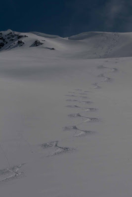
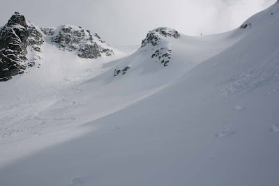
On the 4th day (5th day?), the weather finally improved enough for us to head out for a tour to check out the surroundings. The weather cleared as the day wore on, and by 1-2 pm, we were headed up the couloir behind our camp, which leads up to a col on the ridge leading to the NE from the summit of Chakachamna. We took one run from halfway up the gully to check on stability and feel it out, and then once we reached the bottom we decided to throw the skins back on and point the tips back up the 2000’ run.
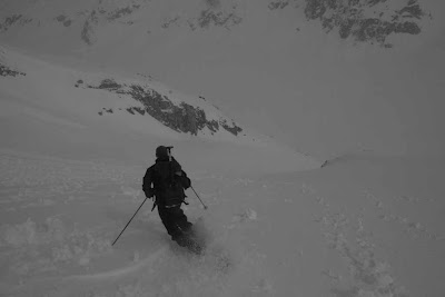


We topped out a couple of hours later in strong winds and decreasing visibility around 5 pm. The soft snow turned to wind buffed hardpack and ice at the top of couloir, and we bootpacked the last couple of hundred feet. We snapped a few photos and then I dropped in, side slipping for a turn or two before getting to the good stuff. Despite the worsening conditions, we had a great time skiing down through the rock towers, surrounded by the seracs of a remnant glacier and soaring turrets of granite. Fun!
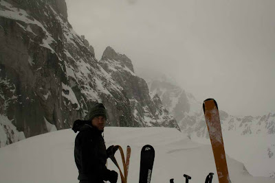
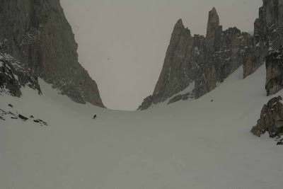


The next day we woke up to even better weather.
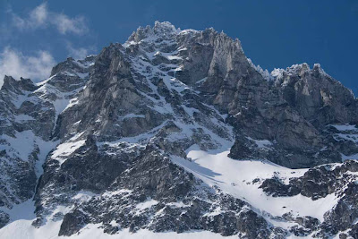


The sun had hammered the south facing lines, so we went across to the other side of the glacier, where we hoped the conditions would be better.
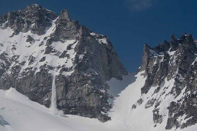
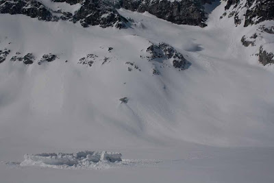


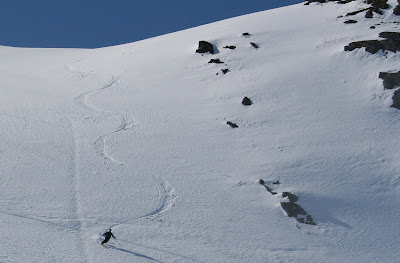
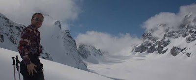
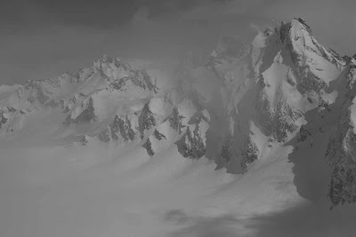
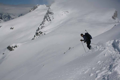
We had made a quick tour over there in pretty bleak conditions on day three, and knew there were some great lines to be had and that the snow was fairly stable. Some of the shots from an excellent day.
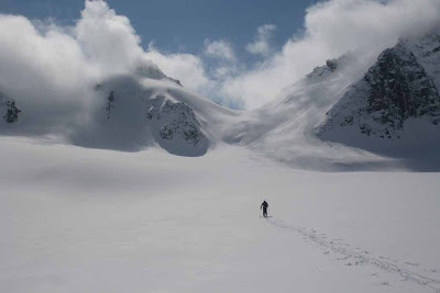
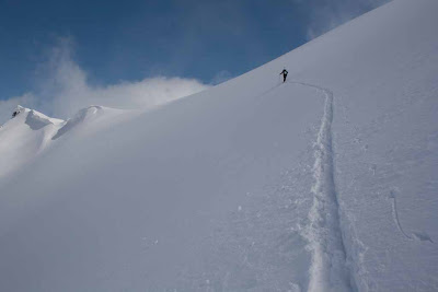
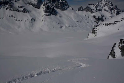


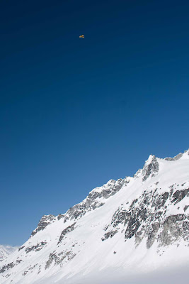
That afternoon, Doug picked us up around 5 pm.


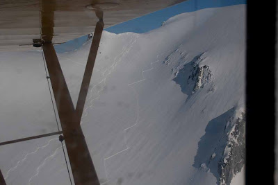
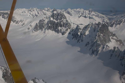
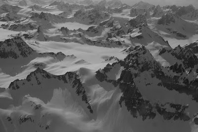
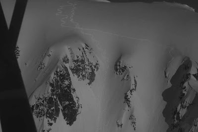
and we got the rare pleasure of checking out our lines from the air.


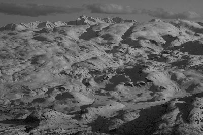
We considered sticking it out for another couple of days, but we were getting bad weather reports and decided to take our weather window.

All in all a great trip! We didn’t get to climb anything, because the mountains were shedding feet and feet of snow like a winter skin, but the skiing was incredible, and we had a great time.

This area has incredible potential! Especially if you have the time and patience to wait for the weather window. Drop me a line if you want any additional information – lots of climbing and skiing objectives to be had from that base camp and the surrounding glaciers.
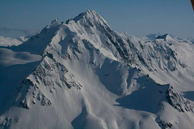


Here are some more pics.

And yet more pics from Brian.

Go freakin' get some!

Thursday, May 29, 2008

Barrow, Alaska - May 7-9, 2008


For the last year, I’ve been working with several groups representing Inupiat Eskimos on the North Slope of Alaska. For thousands of years, the Inupiats have relied on the subsistence hunt of bowhead whales and other marine mammals in the Beaufort and Chukchi Seas of the Arctic Ocean.

In April of 2007, Royal Dutch Shell put forth an exploration plan proposing to drop two large mobile drill rigs and dozens of associated support vessels directly in the middle of the Inupiats’ subsistence hunting grounds during the fall whale hunt. Map. In some places, whale meat makes up as much as 50% of their annual diet, and the proposed drilling activities threatened to disrupt the fall hunt and jeopardize the safety of the Inupiat whaling crews.

Last year, I represented the North Slope Borough, the Alaska Eskimo Whaling Commission and the Inupiat Community of the Arctic Slope in a challenge to Shell’s exploration plan. We argued that the Minerals Management Service illegally disregarded the potential impacts to subsistence activities in approving the exploration plan. Here's our main brief. In August, the 9th Circuit Court of Appeals issued an injunction setting aside the exploration plan as Shell was mobilizing its fleet and moving ships into place. A Reuters article --- NY Times Article.

This month, I was lucky enough to travel to Barrow to meet with members of the North Slope Borough and ICAS. We won the first round of litigation, but the pressure to extract oil and natural gas from the Arctic is increasing. I wanted to travel to Barrow to meet folks face to face and learn more about their traditions and practices.

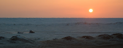
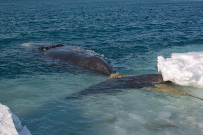
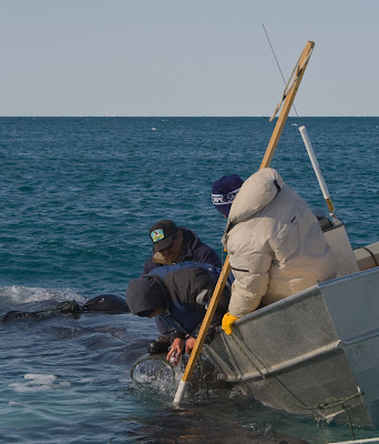
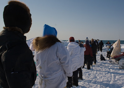
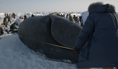
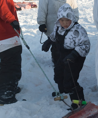
On the day I arrived, one of the whaling crews landed one of the first bowheads of the season, and before I had been in Barrow more than a few hours I found myself at the edge of the pack ice helping to prep the whale to be hauled up out of the water.


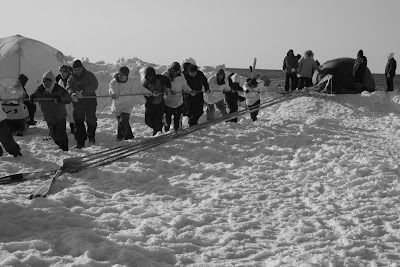
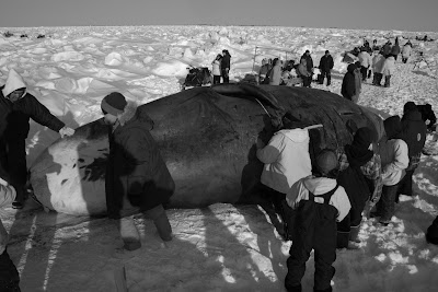
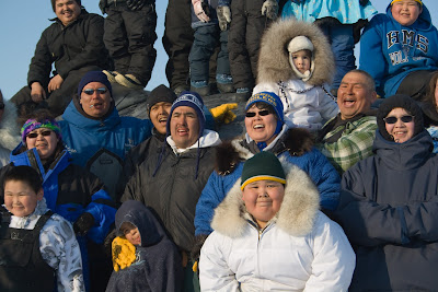
For the next several hours, I watched as dozens of family members arrived on snow machines and we started the long, slow process of hauling the 30 ft. whale onto the ice by hand.


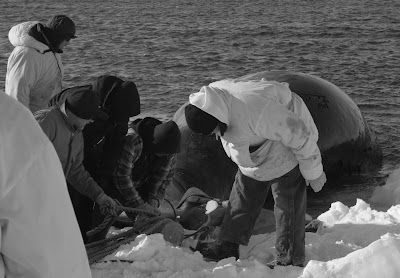
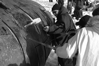
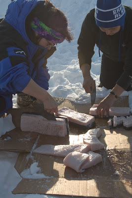
Once we got the whale out of the water, they started processing the whale meat, which will be distributed to the family and other members of the community who need food. Using traditional tools, the whale meat was cut into smaller chunks and staged on the ice before being loaded up into sleds and towed off towards the village.


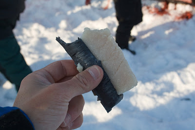
Some of the meat was boiled on site for folks to enjoy. Yum. Maktak.


At the same time, scientists from the Borough’s Dept. of Wildlife collected data and tissue samples from the whale.


They send people out to every whale that is landed and have assembled an impressive database of information on the bowhead whale over many years. The Borough’s scientists, who probably know more about the bowhead than anyone else in the world, provided invaluable assistance in the court case, explaining how whales react to underwater noise associated with drilling and icebreaking activities. I got a chance to meet the scientists in person and learn more about the whale and its annual migration from the Bering Sea through the Chukchi and into the Beaufort and back.

I came away from the trip with a much better appreciation for the culture and traditions of the Inupiat. The whale hunt provides the very foundation for their diet, family, psychological health and the maintenance of their history and traditions.


I look forward to offering my help as they face continuing threats to subsistence activities from the oil industry.